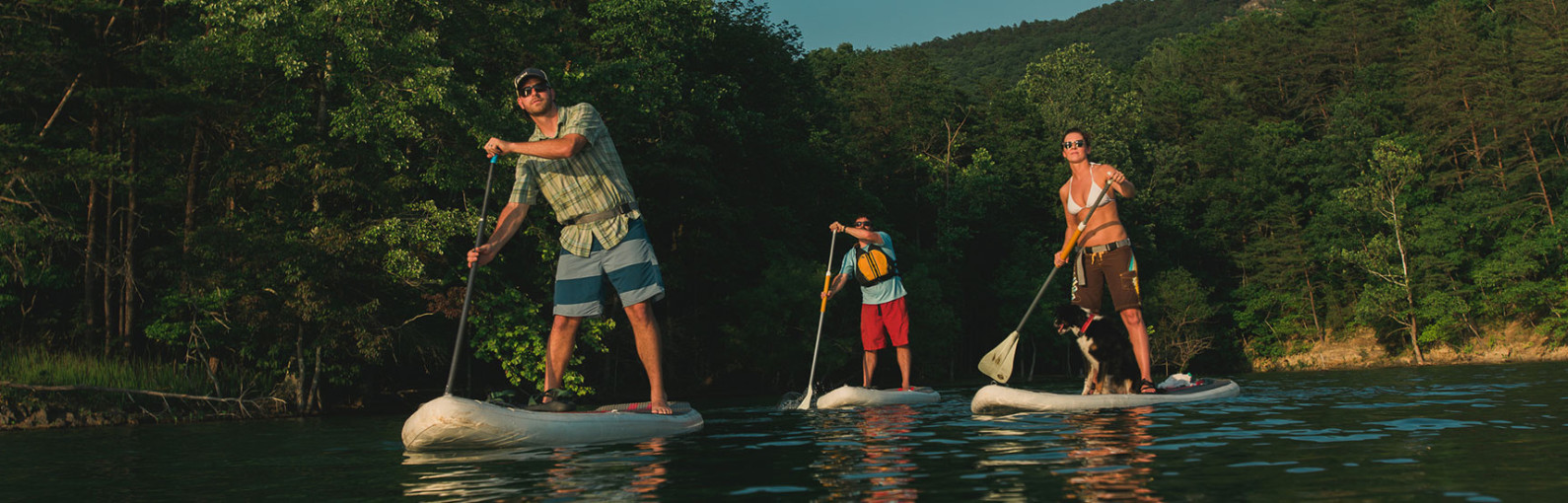
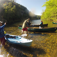
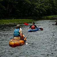
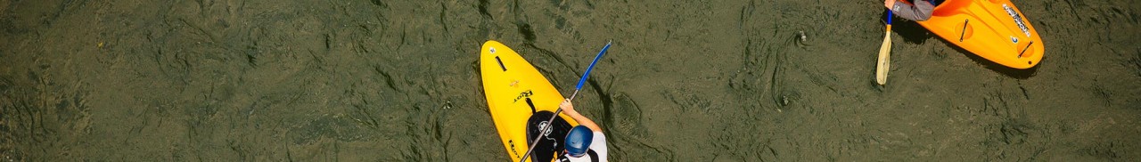
Canoeing, Kayaking & Standup Paddling

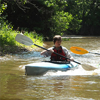
Paddling
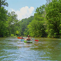
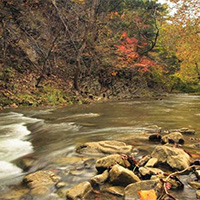
Looking for a relaxing float with your family, or are you looking to hone your paddling skills on some classic whitewater runs? Whatever floats your boat, you’ll find it in the Roanoke Region of Virginia.
Find a Paddling Trip
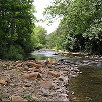
Rivers
-
Bullpasture River


 Bullpasture River is classic Class III+ rapids located in Alleghany Highlands. The river feeds into the Cowpasture River. Paddling from the public access (Route 678) to the Cowpasture River at Bullpasture Gorge is 4 miles.
The gorge is a fun section and is good for intermediates or someone who just enjoys Class III fun in a scenic gorge. The rapids become more difficult the further into the gorge, so it gives those who are stepping up to Class III a chance to warm up.
-
Cowpasture River
 The Cowpasture River flows through some of western Virginia’s most scenic, rural landscapes. Beginning in Highland County, it flows south through Bath, Alleghany, and Botetourt counties for more than 80 miles. At Iron Gate, it joins the Jackson River to form the James River.
Find flow information for the Cowpasture River:
- McKinney Hollow (Clifton Forge)
- Williamsville (Bath County)
-
Jackson River
The Jackson River contributes a distinct and scenic landscape feature, while providing a natural habitat for reproducing wild trout. The Jackson River starts at Lake Moomaw, where water is released from the Gathright Dam, and flows 43.5 miles to where it merges with the Cowpasture River and forms the James River. The Jackson is an excellent smallmouth bass, rock bass, rainbow trout, and brown trout fishery.
Note: their is a mandatory takeout on the Jackson River between miles 24-26.
The Jackson River Scenic Trail is a cinder rail trail that parallels the Jackson River for about 16 miles.
-
James River
 The James River is a popular river for boating, canoeing, and kayaking. The largest drainage river in Virginia offers Class I to Class III+ rapids.
The James River begins its journey in Botetourt County, winding through the Allegheny and Blue Ridge Mountains on its way to the Chesapeake Bay. The unspoiled beauty of the river is more accessible than ever through the Upper James River Water Trail. Paddlers, anglers and families can get back to nature and enjoy the sights and sounds of 45 miles of the Upper James, including 14 pristine miles designated as a Virginia Scenic River.
-
Little River
 Little River offers Class I-III+ depending on water levels. The section of river between Riner (Route 8) and Copper Valley (Route 787) is 12 miles.
 -
Maury River
The Maury River provides 37 miles of paddling and fishing fun. This Class II-IV river is best run April through June and with higher water levels.
- The Rockbridge Baths section includes Class II-III rapids
- The Goshen Pass includes Class II-III, with one Class IV that is easily portaged (Devils Kitchen)
-
New River
The New River is a great fishing, tubing, canoeing, and kayaking spot featuring Class I to Class III+ water. The New River is the second oldest river in the world, giving anglers and paddlers world-class excitement, and is one of the few rivers that flows north. It is ideal for kayaking, canoeing, tubing, and fishing.
There are multiple outfitters serving the New River to help you plan your trip or provide a place to park or grab gear.
-
Pigg River Blueway
The Pigg River Blueway makes for a relaxing float in Franklin County. This Class I water is great for a nice fishing float or a leisure canoe trip with the family.
Starting at the 500 acre Waid Recreation Area, this eight mile float takes you through the rolling countryside south of Franklin County. The float takes about four to five hours to complete, making it the perfect weekend activity. The take-out is in Lynch Park, a 3-mile shuttle for your vehicle.
You will want to check water levels before attempting this float. Generally speaking, if the Blackwater gauge shows 2.3 feet, the river will be at the perfect level.
-
Roanoke River
The Roanoke River offers a unique combination of urban, front country, and back country recreation opportunities in the upper Roanoke River watershed. Enjoy canoeing, kayaking, fishing, tubing, wading, wildlife viewing, and watershed education with convenient access to other outdoor and cultural amenities.
-
Smith River
Smith River has strong and challenging waters (Class II), especially when water is released from the Philpott Dam. It is perhaps the best option for play waves in southern Virginia during the late summer.
There are almost 12 miles to float. Put-in at the base of Philpott Dam and take-outs placed about every 6 miles downstream.
This is a quite scenic route as well. Check out the fog that forms on warm, humid days as the cold water reacts with the air. There are times when you can’t see 30 feet in front of your boat. It makes a totally unique paddling experience in Virginia.
-
Upper Blackwater River Blueway
 The Upper Blackwater River Blueway is a 35-mile section with many paddling possibilities. Located about 25 minutes from Downtown Roanoke, this delightful float takes you through the foothills in Franklin County.
Starting in the headwaters of Cahas Mountain, the Blackwater River continues until it terminates in the backwaters of Smith Mountain Lake. The float is a water dependent run so pay attention to gauges. Generally speaking, you need at least 2.3 feet on the Blackwater gauge to make the run enjoyable. Don’t miss the section from U.S. 220 to the Farm View Road ford as this section has a series of low Class II water that is a blast for beginners.
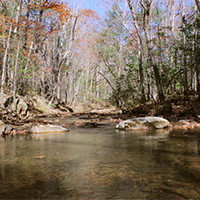
Creeks
-
Barbours Creek
 A stocked trout stream. At high water levels it becomes a Class III stream. It is located near The Pines campground in Craig County.
 -
Bottom Creek
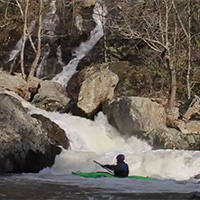 Bottom Creek is a solid Class V+ steep creek with mandatory portages. It is highly recommended that your first run be with someone who knows the river well.
There are usually at least two or three carries, but there is always at least one mandatory portage in there – you must get out at the right spot above “Eye Of The Needle” (aka, “Inner Earth”). It is easy to miss this exit point and drop past the point-of-no-return. Most boaters, at most flows, carry “Gravity Cavity” and “Gorilla North” as well.
-
Catawba Creek
 Catawba Creek is located in Botetourt County and at high water becomes a Class II-III run. The creek includes 12 miles of paddling between Fincastle (Route 616) and the James River (Route 726).
 -
Craig Creek
 Craig Creek is popular for kayaking, rafting, and paddling in Class I-II waters.
The float is along an incredibly beautiful shallow creek that meanders its way through lush vegetation. It is best paddled in the fall or spring, or after a significant rainfall. There are several sections to float between New Castle and Eagle Rock.
Wilderness Adventure at Eagle Landing an outfitter located along Craig Creek, can provide water level updates, canoe, kayak, or tube rentals, camping and cabin rentals, and even provide shuttle service.
-
Dunlap Creek
 Dunlap Creek features Class II-IV waters in Alleghany County. There are 18.5 miles of creek between Crows (Route 311) and the Jackson River.
 -
Jennings Creek
 Jennings Creek is a stocked trout stream. At higher levels it becomes a great Class II-III run between Route 614 and the James River (4.5 miles).
 -
Little Stony Creek
Little Stony Creek begins at the Cascade Falls trailhead and feeds into the New River. It features Class IV-V waters and is 1.6 miles. This stocked trout stream becomes a Class V+ creek at high water.
-
Little Walker Creek
Little Walker Creek is a scenic Class I-III float near the New River. The 7.5 mile stretch runs from Alum Springs (Route 643) to Big Walker Creek (Route 100).
-
North Creek
North Creek is a great fishing stream and at higher levels features a Class II-IV creek run. The 2.5 mile stretch runs from the campground to Jennings Creek.
-
Potts Creek
Potts Creek offers tremendous fishing at low water levels and at higher levels it provides great Class II-IV whitewater. One of the most popular sections of the 32.5-mile section between Pint Bank and the Jackson River is to start near the campground near Paint Bank, a section with Class II-III rapids.
-
Roaring Run
 Roaring Run is an excellent hiking trail for the whole family. The easy, well-marked trail begins at a historic iron furnace and winds back and forth along the Roaring Run stream. You will pass rock walls, cascading water, and cross five footbridges before ending at beautiful Roaring Run Falls.
It is also a great trout stream with a natural water slide at lower levels. At higher levels, it becomes a Class V+ creek.
- Easy (out and back hike)
- Approximately halfway to the falls is a natural water slide
- Toilets and picnic area with charcoal grill
-
Stony Creek
Stony Creek is a stocked trout stream that feeds into the New River near Pearisburg. At high water levels, it is a classic Class III-V creek that spans 7 miles from the Jefferson National Forest (Route 635) to Big Sony Creek.
-
Walker Creek
Walker Creek feeds into the New River in Pearisburg. It is a Class I-II whitewater run, when water levels are at their best. The Walker Creek section extends 29.5 miles from White Gate (Route 713) along the New River (Route 636) to Big Walker Creek.
-
Wilson Creek
Wilson Creek is a Class II-III section of whitewater that begins inside Douthat State Park. The 7.5-mile section of creek flows from the Douthat Lake dam to the Jackson River.
Lakes
-
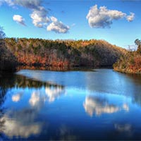
Carvins Cove Natural Reserve
Carvins Cove Natural Reserve is the second largest municipal park in the nation. It holds a major water source within its 12,700 acres and overflowing recreational opportunities including hiking, biking, fishing, and boat rentals. The cove includes 11,363 acres that are protected by the largest conservation easement in Virginia’s history.
With more than 60 miles of trails and an 600-acre reservoir Carvins Cove is a mountain biking, hiking, horseback riding, fishing, and boating paradise.
- There are three entrances to the Cove:
-
Claytor Lake
Claytor Lake is a 4,500 acre lake with a marina, three public boat ramps, and a public beach. Public access is somewhat limited but there is a good boat launch area at Claytor Lake State Park on the northern shore of the lake. The state only stocks smallmouth bass and walleye but there is a fair population of muskellunge in the lake as well.
-
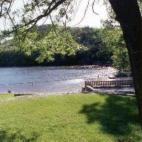
Douthat Lake
 Douthat Lake is 50-acre lake at Douthat State Park that offers swimming, boating, boat rentals, and fishing.
Douthat is listed on the National Register of Historic Places for the role its design played in the development of parks nationwide. Amid some of Virginia’s most breathtaking mountain scenery, visitors enjoy interpretive programs, four miles of stream fishing, the is lake stocked with trout, a sandy swimming beach with snack bar, boat rentals, a gift shop and camp store, cabins, and more than 43 miles of hiking, mountain biking and bridle trails.
Plus, there are playgrounds, an amphitheater, picnic areas, tent and trailer camping, and a restaurant overlooking the lake. The park has 32 cabins and three lodges that accommodate 15, 16 or 18 guests each.

-
Douthat State Park
Douthat State Park was named one of the nation’s 10 best by Outside Family Vacation Guide. It is one of the original six Virginia State Parks. Nestled in Virginia’s Western Highlands, Douthat features some of Virginia’s most outstanding scenery.
- Swimming beach
- Boat, kayak, and canoe rentals
- Cabin rentals
- Campsite rentals
Some people refer to it as the Disneyland of mountain biking. There are more than 43 miles of wooded hiking trails and mountain biking trails to choose from, ranging from easy to difficult. Many park trails climb up the side of the surrounding mountains for several miles and reward mountain bikers with grand views and long flowing descents.
-
Lake Moomaw
Nestled among Bolar, Oliver and Little mountains Lake Moomaw is a jewel about 90 minutes drive north of Roanoke. Because it is completely surrounded by the George Washington National Forest this beautiful lake has been spared development. Access to the entire lake is open but boat ramps are primarily undeveloped and suited only to watercraft that can be carried, with the exception one small marina operated at the southern tip of the lake. The lake is quite deep and boasts healthy populations of reproducing brown and rainbow trout. The state periodically stocks both large and smallmouth bass to supplement the existing populations.
-
Loch Haven Lake
 Loch Haven Lake is a small private lake for corporate and member events. Members can enjoy a swim in the spring-fed lake, play tennis, volleyball, horseshoes, or ping pong, paddle the lake in a canoe or kayak, or just relax with a book on the beach.
 -
Philpott Lake
 Phillpot Lake is relatively small in surface area but rich in shoreline. Backed up behind the Army Corps of Engineers Phillpot Dam project, the reservoir is deep and boasts lots of small coves providing great cover for the resident populations of bass and walleye. Access is very good with public boat ramps at Fairystone State Park and various locations throughout the Fairystone Farms Wildlife Management Areas.
There is no residential development along its shoreline but there are numerous facilities scattered throughout the reservoir such as boat landings, campgrounds, picnic areas, beaches, and hiking trails.
-
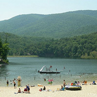
Smith Mountain Lake
Smith Mountain Lake, Virginia’s most popular lake, offers superb recreational activities, 500 miles of shoreline, a wide variety of water sports, and affordable lakefront real estate. Known locally as “SML,” it is the “Jewel of the Blue Ridge Mountains.”
Smith Mountain Lake is best known for its Striped Bass fishery. This lake regularly leads the state in producing “citation” sized stripers. There are also good populations of both large and smallmouth bass. Public access is very good with both public boat ramps and private marinas.
Create Your Own Water Adventure
Get Started Powered by Roanoke Outside