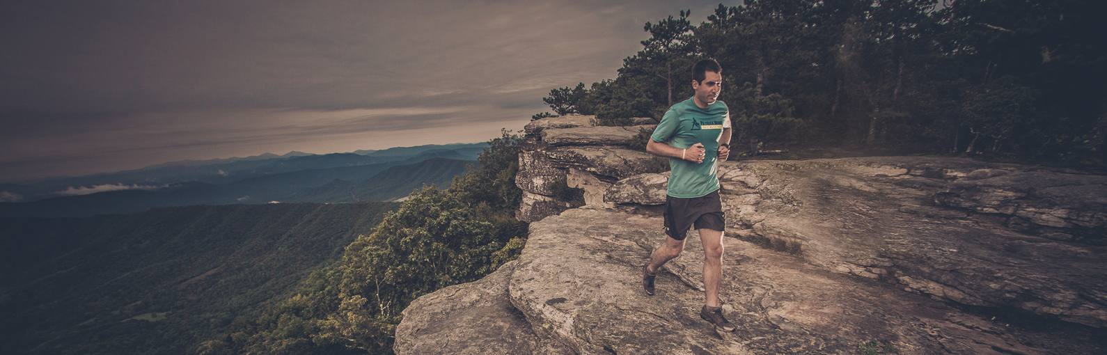

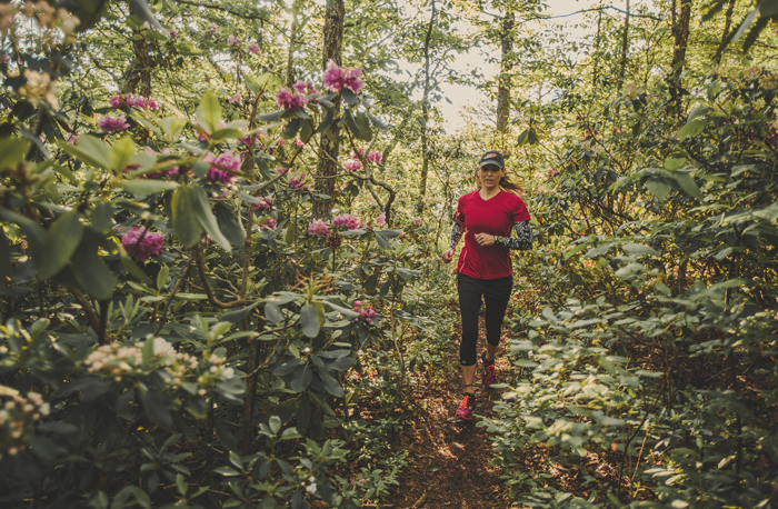
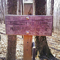
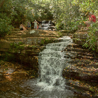
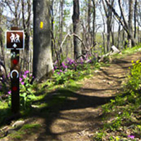
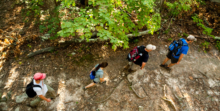
Trail Running
Trail running is one of the most popular outdoor activities in the Roanoke Region.
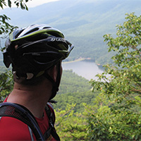
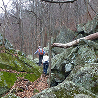
The same elements that make for great mountain biking and hiking, make for great running trails as well. And we have plenty of them throughout the region. Some of the popular trail runs include several routes at Mill Mountain Park, the Patrick Henry High School cross country course, Carvins Cove, and more strenuous runs along the Appalachian Trail.
And it’s so easy to get to the trail. Some of the best running in the region is accessible just 5 minutes from downtown Roanoke. You can even get to the trails by foot or bike to extend your time outside.
You can find great descriptions of various trail runs, including mileage, below and from Mountain Junkies. You can also find some of the most popular segments on Strava.
Don’t be intimidated by the idea of running on the trail. With varying terrain, there’s something for almost every trail runner, from beginner to ultra-runner. Find a great run (and group to run with): The Roanoke Valley Trail Runners gets together for group runs almost every Tuesday throughout the year.
Here’s the mission of the Roanoke Valley Trail Runners: “This group has been created for all trail runners at different levels to get together and have a relaxing trail run at the beginning or the end of the week. Will at least have two runs a month on Roanoke and surrounding trails. Runs will be 4 – 6 miles at a nice comfortable pace. BEGINNERS ARE WELCOME NO RUNNER WILL BE LEFT BEHIND.”
The trail running community is strong in the Roanoke Region. Participation at trail running events is growing each year. Just remember that the trails are for everyone and you might come across other users — hikers, mountain bikers, and even wildlife. Make sure to be aware of your surroundings or hit the trail with a friend.
Major events
- Frozen Toe 10K (January)
- Montvale 5 & 10 Miler (March)
- Mill Mountain Mayhem 10k (April)
- Trail Nut 10K and Half Marathon (May)
- Conquer the Cove 25K and Marathon (June)
- Into the Darkness Night Trail Run (October)
Trail Running
-
Angel’s Rest


 The climb to Angel’s Rest above Pearisburg is notorious among Appalachian Trail hikers for its punishing incline. You must endure a 1.5-mile, 1,650-ft. climb before you can sprawl over a boulder enjoying the view of the New River. The hike is 4.6 miles round trip.
The well-worn trail leads into a spring-fed ravine and briefly along an old logging road before settling into a consistent, thrashing course of switchbacks. The path crosses over two ancient rockslides and passes through thick poplar and oaks, as well as laurel and rhododendron.
Gradually, the thriving hardwood forest of the lowlands gives way to stunted oaks and shrubs. When you reach the boulders at the top, detour a few hundred feet to the right on a blue-blazed trail for a view of Pearisburg and the twisting New River. The A.T. continues to the crest of Angel’s Rest and follows along a rock ledge overhanging Wilburn Valley for spectacular views.
-
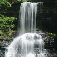
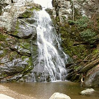
Apple Orchard Falls
 Apple Orchard Falls is one of Virginia’s tallest and most spectacular waterfalls. Singing streams, dancing down cascades, huge boulders, and thick stands of forest surround stunning vistas and towering bluff lines. The 7.5-mile loop trail is moderately difficult.
Apple Orchard Mountain was named for the nature of the dominant northern red oak forests on its summits and ridges. The weather is so severe on the upper elevations of the mountain that the trees have taken on a stunted appearance, as if they have been trimmed and pruned over the decades.The Appalachian Trail and the Blue Ridge Parkway pass within a short distance of the top of Apple Orchard Mountain.
-
Beards Mountain Trail
 Beards Gap Trail starts up right side from the Douthat State Park visitor center, and initially passes over a wooden footpath. Follow the blue-blazed trail as it heads up the gap. The trail will make several switchbacks before arriving at the ridge, and intersection of the Bushy Hollow and Mountain Top trails in 1.1 miles.
Follow several other trails for a 5+ mile loop hike.
-
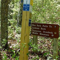
Blue Suck Falls
 The Blue Suck Falls Trail is an 8-mile moderate to difficult multi-use trail that connects several of the trails in the northwest region of the park to the trail head near the visitor center at Douthat State Park.
The falls and trail get their unusual name from the Appalachian term for a whirlpool or a “suck,” which may be found at the base of the falls. At higher elevations, the trail traverses the ridge top, often along a narrow path, and connects to the George Washington National Forest trail network. The trail features several east facing overlooks of the Alleghenies such as Lookout Rock. A highlight of the trail are the views of Blue Suck Falls. This rocky trail is actually steeper and more difficult at lower elevations.
-
Bottom Creek Gorge Preserve
 Forming the headwaters of the Roanoke River, Bottom Creek Gorge boasts spectacular scenery including the second highest waterfall in Virginia, virgin hemlocks, and hundreds of wildflowers.
Bottom Creek is a powerful mountain stream that forms a stair-step series of broad-basin waterfalls known as the “kettles.” One of the headwater streams of the South Fork of the Roanoke River, Bottom Creek boasts a 200-foot high waterfall. Flanking Bottom Creek are forests of mixed hardwoods (tulip poplar, maple, oak, hickory) and upland meadows. Five rare species thrive in this habitat.
NOTE: Dogs are not permitted at Bottom Creek Gorge Preserve.
-
Buck Mountain Trail
Buck Mountain Trail is a very short trail that takes you away from the parking lot and instantly into a virtually untouched spot in nature. There are rocks to climb, trees to explore and wonderful spots to sit and listen to the birds around you.
Buck Mountain Trail is located in the upper parking lot of Roanoke Mountain Loop Road, located off the Blue Ridge Parkway at Milepost 120.
-
Buck Run & Locust Spring Run Trails
 Buck Run and Locust Spring Run Trails are located on the turn-of-the-century railroad tram grades used by the previous landowner to log virgin timber.
- The 2.9-mile Buck Run trail provides a spectacular view of beaver ponds, open glades, and bogs.
- The 3.1-mile Locust Spring Run trail provides views of northern hardwoods and is ideal for viewing whitetail deer and wild turkey.
-
Buffalo Mountain Natural Area Preserve
 Buffalo Mountain, outside of Floyd, is one of the most significant natural areas in Virginia. It boasts an amazing 13 rare plant occurrences, three rare animal occurrences, and six significant natural communities. The combination of high-elevation (3,971 feet), wind-exposed openings at the summit, and magnesium rich soils make it unlike any place else in Virginia.
Public access facilities include a small parking area and a steep 1 mile hiking trail to the treeless summit.
-
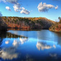
Carvins Cove Natural Reserve
Carvins Cove Natural Reserve is the second largest municipal park in the nation. It holds a major water source within its 12,700 acres and overflowing recreational opportunities including hiking, biking, fishing, and boat rentals. The cove includes 11,363 acres that are protected by the largest conservation easement in Virginia’s history.
With more than 60 miles of trails and an 600-acre reservoir Carvins Cove is a mountain biking, hiking, horseback riding, fishing, and boating paradise.
- There are three entrances to the Cove:
-
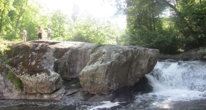
Cascade Falls Trail
 The trail leads to Cascade Falls, one of the most beautiful waterfalls (69 feet) in Virginia and possibly on the entire East Coast. Little Stony Creek cascades over a vertical cliff in several different streams.
- ~ 3.5 miles in length, out and back hike
- Easy to moderate difficulty
- There is a day-use fee of $3 (cash only)
- Map kiosk at trailhead (straightforward hike)
-
Chestnut Ridge Trail
The Chestnut Ridge Trail is located along the Blue Ridge Parkway. It is a wide and well-graded path lined with mountain laurel and rhododendron and includes a 5.4 mile figure-eight loop trail that can be shortened to 2.5 or 3.4 miles.
The easy to moderate trail is just 10 minutes from Downtown Roanoke and is also adequate for horseback riders.
-
Cobbler Mountain Trail
 This trail offers 2.67 miles of excellent hiking in the Hidden Valley Recreation Area.
This trail meanders through a variety of habitats and offers many opportunities to view wildlife. Begin at the shale pit and take the short climb to the ridge top before ascending to the Chimney Run crossing. Enjoy rock formations and the cool stream environment while you cross over a wooden bridge. Hike through a small field with views of the Warwick Mansion and the Hidden Valley fields. Enter the woods in a serene valley located next to a wildlife pond, where it is common to observe waterfowl. Continue on an old road bed that leads to Muddy Run and the Jackson River. The trail ends on the Muddy Run Trail, approximately 1.5 miles northeast of the parking lot by Warwick Mansion.
-
Crabtree Falls
Crabtree Falls is arguably the most beautiful set of waterfalls in Virginia. Billed as the tallest waterfalls east of the Mississippi, Crabtree Falls is a must-see for anyone who lives in the mid-Atlantic region.
Arrive at the top of the falls just 1.1 miles from the parking area and cross over a wooden bridge to an overlook. From here you can’t see Crabtree Falls below as it falls away, but there is still a nice view of the valley floor and the Blue Ridge Mountains. Don’t be tempted to climb over the stone wall onto the uppermost portion of the falls. The rocks are covered with very slippery algae.
-
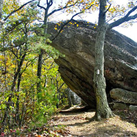
Devil’s Marbleyard
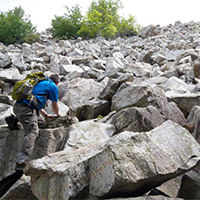 Devil’s Marbleyard includes a steep incline for most of the trip, but is well worth the time. The trail is not marked well, but you can follow the blue blazes until the end of the Belfast Trail. Then continue to follow the trail.
The hike itself is not that long, about 45 minutes, but you will definitely want to plan time to stay at the marbleyard and explore.
Devil’s Marbleyard is a boulder field, with many rocks that are the size of a car. The Antietam Quartzite found at the site is the result of a rise in sea level relative to the land that occurred over 500 million years ago. The boulders have tube-like structures running along them that are believed to be fossilized cavities where worm-like creatures lived.
-
Dismal Falls
 Dismal Falls is a 15-foot, multi-tiered waterfall on Dismal Creek. It is easily accessed from the road or from a side trail off of the Appalachian Trail.
Dismal Creek is about 50 feet wide (depending on water volume) at this point as it flows down over several ledges. The ledges on the left side of the falls are step-like while the middle and right ledges are more of a straight drop. In lower water, the middle and right are not covered and the stream is much narrower. Despite the width of the stream, the waterfall is not particularly open with trees lining each bank and throwing much of the falls into shade most of the day.
-
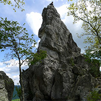
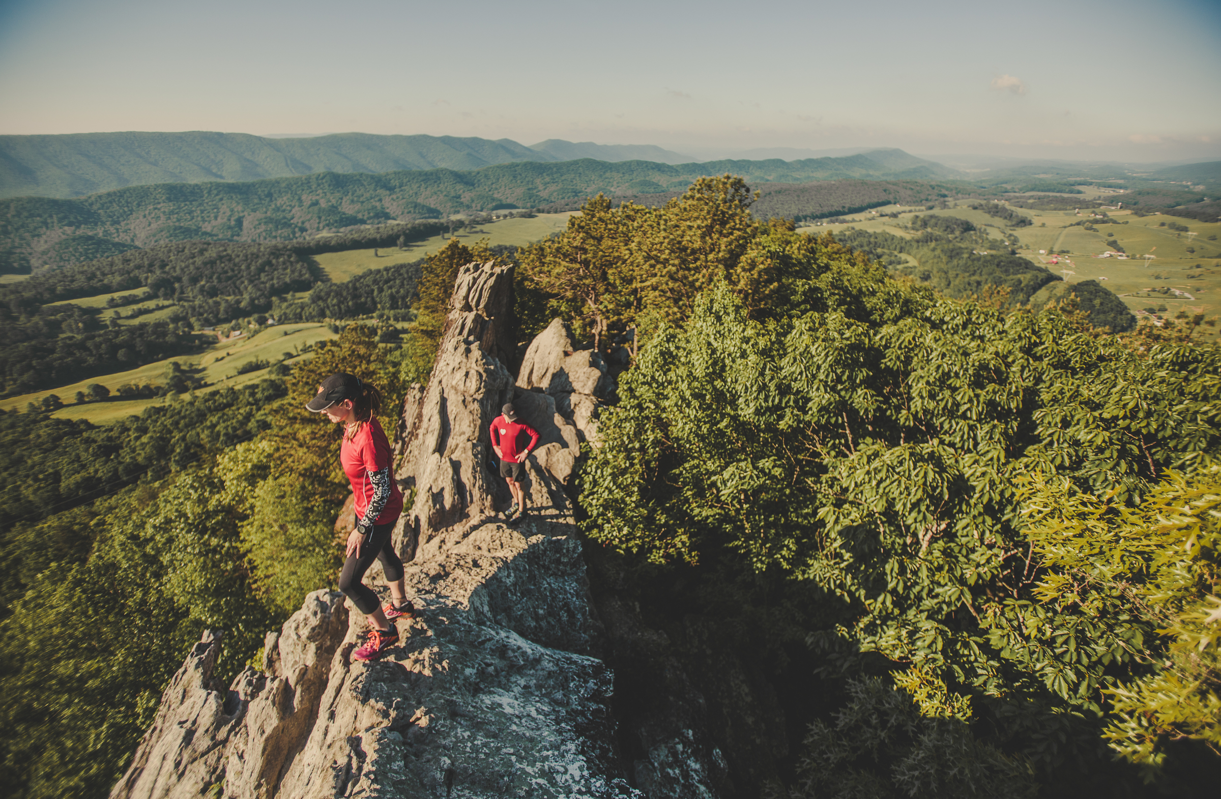
Dragon’s Tooth
Dragon’s Tooth is a unique geologic feature that consists of
 Tuscarora quartzite spires which outcrop on the top of Cove Mountain. The tallest “tooth” projects roughly 35 feet above the surrounding rock. The trail to Dragon’s Tooth ascends steep, rugged outcrops of quartzite which form the spine of Cove Mountain and North Mountain. The spine is known as Dragon’s Back.
Note: The Dragon’s Tooth hike is one of the most popular hikes along the entire Appalachian Trail and sees a tremendous amount of hiker traffic. The trailhead parking lot (Rt. 311) has limited space; DO NOT PARK on Rt. 311 – YOU WILL BE TOWED. It is ideal to hike this on a weekday as weekends are very crowded. Vehicles not parked in the parking lot are subject to tow. Please read specific rules and regulations at the bottom of this description.
Hike Description
- ~ 4.5 mile round trip, out and back hike.
- Moderate to difficult.
- 20 minutes from downtown Roanoke.
- Map kiosk at trailhead (very straight forward hike). Take a picture of the map so you have it on your phone.
- The trail starts with a kiosk at the back of the parking lot. You will follow the blue-blazed trail to the very top.
- Go 0.25 mile and cross two small bridges.
- You’ll see the intersecting yellow-blazed Boy Scout Connector Trail. Bear right and continue on the blue-blazed trail.

- Continue for nearly 1.5 miles, crossing the creek several times on a steady incline before reaching the Appalachian Trail intersection.
- Turn right to go south on the white-blazed Appalachian Trail. There will be 0.7 miles of steep rock steps before bearing left at the intersection to follow the blue-blazed trail to Dragon’s Tooth.
- Come back the way you went up, or once you reach the Appalachian Trail, go beyond the blue-blazed trail you started on and continue north on the A.T. until you reach the yellow-blazed Boy Scout Connector Trail. You’ll go left on this trail until you reach the blue-blazed Dragon’s Tooth Spur Trail, and go right toward the parking lot. This second route back offers different scenic views.
Directions to Trail Head
- From Roanoke – take I-81 south to Exit 141. Turn left at the traffic light onto Rt. 419 (Electric Rd.) and follow 0.4 miles to next traffic light (Rt. 311). Turn right onto Rt. 311N and follow for 10 miles. Dragon’s Tooth parking lot is on left just past Catawba Grocery.
Rules & Regulations
- Max. group size for day hikes is 25 people.
- Max. group size for backpacking/camping is 10 people.
- No alcohol
- Bring lots of drinking water
- Bring a flashlight as groups often lose track of time and are hiking back in the dark
- Dogs must be on leash at all times (be aware there is a section where you will have to lift your dog up a 6′ wall)
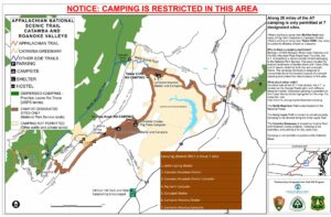
- No camping or campfires on Dragon’s Tooth, McAfee Knob or Tinker Cliffs
- Practice Leave No Trace
- Pack out all trash
- No camping or campfires outside of the 7 designated shelters/camping areas.
- Visit local A.T. C. Club for more details.
Add On
- Finish your day with a great meal at the Home Place – a restaurant famous among thru hikers. To reach the Home Place, continue north on Rt. 311 for ~1 mile to a large white farmhouse on left.
- Grab a beer at Parkway Brewing Co.
- Go see a baseball game! Click here for Salem Red Sox schedule
-
Explore Park
 Explore Park, located adjacent to the Blue Ridge Parkway, is a 1,100-acre preserve, situated along the Roanoke River Gorge, offering both IMBA-certified mountain bike trails and access to hundreds of miles of the Blue Ridge Parkway. Mountain bike trail options (6+) ranging from 0.5 miles to 10+ miles, and includes a beginner bike skills area. Many of the trails are loop trails, and are easy to moderately difficult.
Explore Park also offers Treetop Quest aerial adventure course, Mayflower Disc Golf Course, river access, camping, cabins/yurts/RVs, and the historic Twin Creeks Brewpub.
-
Fairy Stone State Park
Fairy Stone State Park, the largest of Virginia’s six original state parks (4,741 acres), is home to its namesake “fairy stones.” These rare mineral crosses and the park’s scenic beauty, rich history, and ample recreational opportunities make it a local and regional favorite.
More than 9 miles of multi-use trails and a 168-acre lake will keep you busy. The park is also just minutes from the Blue Ridge Parkway.
-
Falling Creek Park
 The trail network in Falling Creek park is designed for hiking, mountain biking, and trail running and includes 8.5 miles of trails of varying difficulty. In addition to trails, there is an 18-hole disc golf course at the park.
Falling Creek Park is also home to the Fat Tire Frenzy & Bike Festival.
-
Falling Spring
 Falling Spring Falls is a breathtaking 80-foot waterfall that is one of the most visited and photographed spots in the Alleghany Highlands. The waterfall is on Route 220, just 5 miles north of Covington. This is one of the largest waterfalls in Virginia and cascades from an overhanging ledge that is visible from the roadway.
Thomas Jefferson described Falling Spring as a “remarkable cascade … falling over a rock about 200 feet to the valley below.”
-
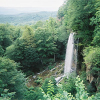
Falls Ridge Natural Preserve
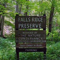 Falls Ridge Natural Preserve features two trails totaling 5 miles. With its nice hiking trails, beautiful waterfall, intriguing caves, rare plants, and convenient location, the Falls Ridge Preserve gets lots of attention. Falls Ridge Preserve is owned and protected by The Nature Conservancy.
Part of a steep, rugged ridge that rises from the valley of the North Fork of the Roanoke River, Falls Ridge Preserve boasts a spring-fed travertine waterfall approximately 80 feet in height.
Salem Fault runs through the preserve, dividing it into two different rock types-Precambrian limestone and shale/sandstone. The corresponding difference in soil types generates a diversity of vegetation, particularly wildflowers and smaller flora.
The rocks in the travertine falls watershed grew steadily, as minerals and lime dissolved in the water precipitate upon them. Over thousands of years, the build-up of calcium carbonate steepened the stream’s gradient and slowly created both the waterfall and one of the largest-known exposed travertine deposits. Large sinkholes on part of the land also indicate the existence of underlying caverns which have never been explored.
NOTE: Dogs are not permitted at Falls Ridge Natural Preserve.
-
Fenwick Mines
 Fenwick Mines was once an old mining area and is now home to trails and a recreation park. The trail takes you by open pit mines and foundations of old mining structures.
The Fenwick Forest Walk is a 1-mile nature trail. The wetland trail allows you to observe wetlands created by beavers; follow the trail through wetlands and open forests to see a variety of wildlife and vegetation that live in this environment.
The trails are wheelchair accessible. The site has a large picnic shelter, grills, toilets, and a fishing pond.
-
Ferrier Trail & Lick Branch Loop
A 7-mile loop trail that provides good views of Craig Creek Valley and Potts Mountain. Lick Branch offers a cool refreshing walk, except during dry periods. A sign marks intersection of the Lick Branch and Ferrier trails.
-
Flat Top
 A classic Virginia 5.2 mile round trip (out and back) hike at the Peaks of Otter. Flat Top is a lovely trail full of wonderful views, large rock formations, and flora that changes with each turn, including huge oak, poplar, hickory, and beech trees, mountain laurel, rhododendron, and an assortment of wildflowers.
 -
Fore Mountain Trail
 A remote 14-mile trail that passes near the highest point in the Allegheny Mountains. It passes through upland hardwoods and pines that are typical of high elevation forests. It is part of a trail system around Douthat State Park.
 -
Franklin County Recreation Park
 Franklin County Recreation Park is a 150-acre park, located south of Rocky Mount (just 2 miles from Route 220). The park offers a variety of outdoor activities for all ages including, fishing in a 3-acre lake. It hosts various special events and athletic tournaments.
Amenities include:
- 2 picnic shelters (available for rent and drop-in)
- Playgrounds
- Lighted tennis courts
- Basketball court
- Sand volleyball court
- Horseshoe pit
- Disc golf trail
- Hiking and biking trails
- Baseball and soccer fields
-
Grassy Hill Natural Area Preserve
Grassy Hill is a prominent landmark on the west side of Rocky Mount.
This preserved parcel of the Virginia natural heritage program offers a pair of loops that run atop Grassy Hill, with oak and hickory forests (which are colorful in the fall) and rocky slopes. Three overlooks provide views of Rocky Mount and the area below.
The trail includes 6.6 miles of hiking trails with signage. Parking for trail users is available adjacent to the preserve.
-
Hanging Rock Battlefield Trail
 The historic Hanging Rock Battlefield Trail offers a touch of local and national history, as well as a pleasant place to walk off lunch. Many wildflowers grow along the trail.
A simple cinder trail winds along the edges of Mason Creek. This rails to trails form allows for quiet solitude away from the traffic. The trail is popular with walkers in the afternoon. Look for falling rock, historical markers, and flowers and berries.
-
Hanging Rock Raptor Observatory
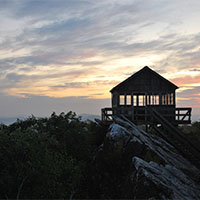 Hanging Rock Raptor Observatory is a half-hour hike with great views (and birdwatching) located in Monroe County, West Virginia. The hike takes you to the observatory. Since 1952, Hanging Rock has been a monitoring point for hawk, eagle, falcon, and osprey migration along the birds’ eastern route.
Hanging Rock Tower is a simple forest service fire tower on top of a mountain. There is no electricity, running water, or bathroom facilities other than an outdoor toilet. You need to take drinking water. Other items you may want to consider are binoculars, food, sunglasses, an extra layer of clothing, sunscreen, hat, bird books, and comfortable hiking shoes.
The hike up the mountain takes 20 to 40 minutes.
-
Harkening Hill
 The lowliest of the three Peaks of Otter, Harkening Hill is the only one with a “loop” trail that swings by the top. A gain of just under 1,000 feet from the parking lot makes it a decent 3.5-mile walk. Harkening Hill sees far less traffic than the bigger Sharp Top, so the trail is in better shape. Many interesting granite boulder formations are found on Harkening Hill.
The loop trail that includes the summit of Harkening Hill starts immediately behind the visitor center. Side trips from the 3.3-mile loop include a trip to “Balance Rock” which is an impressive granite boulder balanced on a smaller one and a trip to Johnson Farm which provides a glimpse of the agricultural history.
If you park somewhere centrally at Peaks of Otter (such as the visitor center or the Sharp Top parking lot), you can hike the Harkening Hill loop and then link to the out-and-back hikes up Flat Top and Sharp Top for a total of about 12 miles.
-
Hoop Hole
 Hoop Hole Loop has two loops. The lower loop is 4 miles and skips the views from the ridge top and the extended loop is 9 miles. Both loops offer beautiful views of the streams cascading over rocks and swimming holes.
The longer loop climbs to the top of the ridge for scenic views of the surrounding mountains. One could try to reach certain cliffs from the ridgetop for more expanded views. The trail is very rugged and good footwear is necessary. Also, the trail makers are sometimes difficult to see with yellow blazes.
-
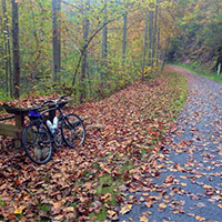
Huckleberry Trail
 The Huckleberry Trail is an asphalt-paved bike and pedestrian path. The trail runs from the Blacksburg Library past the New River Mall in Christiansburg. There are markers every half mile and benches spaced along the trail where you can rest and enjoy the scenery.
Parking is available at both ends as well as near Warm Hearth and the Hightop and Merrimac Road crossings. The trail is 5.7 miles in length with easy walking and biking options.
-
Jackson River Scenic Trail
 A 17-mile trail in Alleghany County, Virginia, which runs from Covington to the Coles Point Recreation Area at Lake Moomaw. The trail, which was developed from an old railroad bed, provides access to many natural, historic and scenic resources.
The Jackson River, running adjacent to the trail, contributes a distinct and scenic landscape feature while providing a natural habitat for reproducing wild trout. There are 14 miles open to the public for those who enjoy hiking, biking, and nature walks.
-
James River Wilderness Trail
A 21.9-mile section of the Appalachian Trail that parallels the James River. This moderately strenuous trail overlooks the James River Water Gap and offers multi-day hiking and camping options.
This is a challenging hike and requires some logistics in setting up a car shuttle because it is a one-way hike on the A.T. Leave a car at the James River Foot Bridge A.T. parking lot then drive to the Blue Ridge Parkway on Route 501 and head south to Sunset Field (MP 78.4) for the second car.
-
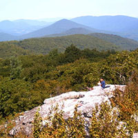
Kelly Knob
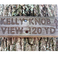 A 6.6 mile, out and back hike on the Appalachian Trail, Kelly Knob is located on a ridge that bridges the valley between John’s Creek Mountain and Clover Hollow Mountain and is immediately off of the Appalachian Trail. While Kelly Knob is not the highest point on the ridgelet (the high point is densely wooded), it is still much higher than its mountain neighbors with a fantastic vista of the New River Valley.
A shorter option (4 miles round trip) approaches Kelly Knob from the opposite direction.
Sandstone bedrock forms a broken escarpment along the east and south of the ridge, and the area around Kelly Knob is particularly striking with 50 foot cliffs containing deep fissures in the rock. The trails to Kelly Knob are well signed and traveled.
-
Liberty Mountain Trail System
 The Liberty Mountain Trail System includes more than 50 miles of single- and doubletrack trails and logging roads spanning approximately 5,000 acres. The mountain rises to over 1,360 feet offering cross country and gravity-fed trails for both hiking and mountain biking. The trail system is located in close proximity to the Liberty Mountain Snowflex Centre, about 1 hour from Roanoke.
 -
Lipes Branch Trail
 A 2.3-mile (round trip) hike up Potts Mountain. The trail passes through the Barbours Creek Wilderness Area and is located near Pines Campground.
- Recommended for more experienced hikers; the first half of the hike is all uphill.
- There are yellow blazes to follow, but they are old and faded and hard to see.
- Allowing four hours for the hike is recommended.
Elevation on top of Potts Mountain is over 3,600 feet, affording great views in all directions. There are no facilities on the trail, but connector (white-blazed) trailheads to Pines Campground have hand pumps for water and vault toilets.
-
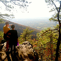
McAfee Knob

McAfee Knob is the most photographed site along the Appalachian Trail. The knob has an almost 270-degree panorama view of the Catawba Valley and North Mountain to the west, Tinker Cliffs to the north and the Roanoke Valley to the east.
UPDATE: The trailhead parking lot on Rt. 311 will be fully (as in 100%) closed for 12 months, beginning 11/30/2023, while construction of a pedestrian bridge across Rt. 311 is built. Only the parking lot will be closed, the Appalachian Trail will remain open. Click here for a list of alternative parking options. You will be ticketed/towed if you park along Rt. 311. Carpooling is recommended.
Note: The McAfee Knob hike is one of the most popular hikes along the entire Appalachian Trail and sees a tremendous amount of hiker traffic. DO NOT PARK on Rt. 311 – YOU WILL BE TOWED. It is ideal to hike this on a weekday as weekends are crowded. Click here for a list of alternative parking options.
McAfee Knob Trailhead Shuttle: Avoid parking headaches by utilizing the McAfee Knob shuttle service. This seasonal shuttle runs every Friday, Saturday, and Sunday, with the occasional holiday Monday. The 2024 shuttle season runs March 1, 2024 through November 26, 2024. The shuttle departs every 30 minutes from Park & Ride at I-81 Exit 140. New for 2024, additional on-demand shuttle stops include downtown Salem, Orange Market, and Dragon’s Tooth trailhead – Learn more and reserve your spot.
Trail Description
McAfee Knob is one of three hikes that make up the Appalachian Trail Triple Crown in Virginia. This overnight backpacking trip begins and ends at the Route 311 Appalachian Trailhead. This is a difficult hike totaling about 32 miles and includes McAfee Knob, Tinker Cliffs, and Dragon’s Tooth.
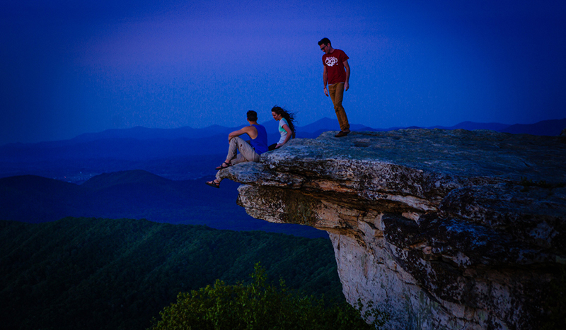
- Approximately 7.5 miles round trip.
- Allow 4-6 hours for full roundtrip hike.
- The trail begins on the opposite side of Rt. 311 from the parking lot. Cross Rt.311 with caution. You will travel north on the Appalachian Trail on to McAfee Knob. Follow the white blazes – which are 6-inch rectangular paint marks placed periodically on trees at eye level.
- After ~0.3 miles you will come to an informational kiosk.

- You will cross four wooden walkways before reaching the Johns Spring shelter. You will then cross five more wooden walkways before reaching the Catawba Mountain shelter.
- Next, you will cross an old fire road and a power line clearing. Continue 0.5 miles further and turn left onto the McAfee Knob spur trail to arrive at the lookout in ~30 yards.
- Retrace your steps or turn right once you reach the alternate fire road for your return trip.
Rules & Regulations
- Maximum group size for day hikes is 25 people
- Maximum group size for backpacking/camping is 10 people
- Bring lots of drinking water
- Bring a flashlight as groups often lose track of time and are hiking back in the dark
- Dogs must be on a leash at all times
- No camping or campfires on McAfee Knob or Tinker Cliffs
- Practice Leave No Trace
- No camping or campfires outside of the seven designated shelters/camping areas
- Visit local A.T. Club for more details
Directions to Trailhead
From Roanoke – take I-81 south to exit 141. Turn left at the traffic light onto route 419 (Electric Rd.) and follow 0.4 miles to the next traffic light (Rt. 311N). Turn right onto Route 311N and follow 5.6 miles to the top of the mountain. The trailhead parking lot is at the very top on the left. Be careful turning into the parking lot as it is a semi-blind turn. Do not park on the side of Rt. 311, you will be ticketed and towed.
Add-on Adventures
- Grab a post-hike beer at Parkway Brewing Co.
- See a baseball game! Click here for the Salem Red Sox schedule.
-
McDowell Battlefield Trail
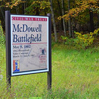 The McDowell Battlefield Trail leads to the top of Sittlington Hill and the core of the McDowell Battlefield. A marker will direct you either east returning to the parking area or west to continue to the western end of the trail.
The eastern end of the trail starts on the south side of Route 250 at the battlefield parking area, approximately 1 mile from the top of Bullpasture Mountain. The western end of the trail starts on the south side on Route 250, directly across from the old mill on the Bullpasture River.
-
Mill Creek Falls
 From the parking area, keep to the left side of the stream and head up the gravel road. You’ll soon come to the Mill Creek dam, which has a shelter and picnic area. Continue to stay to the left of the stream, as the gravel road turns into a rocky trail here. Stay on the trails closest to the stream (marked by signs that say “waterfalls”) and soon you will arrive at the first of three falls. The second and third waterfalls are marked spur trails off to the right of the trail.
To go to Sentinel Point, continue on the trail past the waterfalls and you will intersect the “Piney Road Trail.” Turn right onto the trail, then turn right again onto “Shortcut.” After 0.33 miles this trail intersects “Grassy Road.” Turn right and ascend the steep hill for a great view of the town of Narrows and the New River.
Simply retrace your steps back down Grassy Road, left on Shortcut, left on Piney Road Trail, left on Catwalk, then stay by the stream to return to your car.
-
Mill Mountain Park
Less than 5 minutes from downtown Roanoke, Mill Mountain Park offers incredible mountain biking (9 miles) within 5 minutes of downtown Roanoke. The trails encompass Roanoke’s highest point – the summit of Mill Mountain (1,703 feet) and the Roanoke Star. This area offers 900 acres of parkland atop Mill Mountain, picnic areas, two overlooks that provide 20-60 mile vistas, access to additional hiking trails, the Mill Mountain Zoo, and Mill Mountain Discovery Center.
- Watch a video of mountain biking on Mill Mountain
- See live video from the StarCam
- Download a Mill Mountain Park Trail Map
-
Mountain Lake Conservancy
 The Mountain Lake Conservancy manages 2,600 acres of mountainous terrain that encompasses a unique ecosystem due to an average elevation of more than 4,000 feet.
More than 20 miles of fern-lined trails on the property are open to the public for biking year-round. The trails are home to the “Dirty Dawg MTB Race” and offer trail options for all experience levels. Mountain bike rentals are available at Mountain Lake Hotel.
-
Pandapas Pond & Poverty Creek Trails
 The Poverty Creek Trail system (also known as Pandapas Pond) is a network of multi-use trails perfect for hiking, running, horseback riding, and mountain biking. There are more than 20 miles of trails of varying degrees of difficulty.
Poverty Creek Trail is the easiest of the trails in this system. It is a series of small ups and downs and is ideal for mountain bikers of all skill levels but especially great for those just getting into the sport. Think of Poverty Creek Trail as the “spine;” many trails branch off of Poverty Creek that are more challenging.
-
Panther Falls
Popular swimming hole and water fall Panther Falls is very easy to get to. It’s just under a half mile hike from the parking lot.Panther Falls is located on the Pedlar River just off the Blue Ridge Parkway. The 10 foot waterfall is bordered by two rocks that give you a great view of the refreshing pool of water. Use caution when swimming at there are undercut rocks and strong currents can make it difficult to get out of the water.
-
Pathfinders for Greenways
Pathfinders is a group of citizens who represent the trail users of the Roanoke Valley for non-motorized trail uses, with a vision is to have all area trail users meet and work together on projects that would benefit the community.
- Promote and encourage development of a greenway network in the Roanoke Valley
- Educate citizens and officials on greenway benefits and value
- Raise and receive gifts, donations and grants for greenways
- Organize volunteers to assist with greenway development and maintenance

-
Patterson Creek Trail System
 Located on the border of Craig and Botetourt counties is the Patterson Creek Trail System. This forgotten hiking trail system that is being revived by the Roanoke IMBA chapter and includes multiple loop options and fairly difficult terrain.
 -
Philpott’s Dogwood Glen Trail
 Dogwood Glen Trail is a 5-mile hike with a scenic lake, wildlife, and wooded views. This trail stretches from Salthouse Branch Park at Philpott Lake to the Philpott Park Tailrace.
There are some tough climbs and a few short downhill segments. Various stretches of the trail run along the shoreline of Philpott Lake. The approximately 7-foot wide trail can be accessed from Philpott Dam (Franklin County side) or Salthouse Branch Park. Parking is limited at Salthouse Branch Park ($4 day-use fee) and not accessible for equestrians at that location.
-
Poor Mountain Natural Area Preserve
 Poor Mountain Natural Area Preserve protects the world’s largest population of the globally rare shrub piratebush, which is restricted to only a handful of sites in the mountains of Virginia, Tennessee, and North Carolina.
The “Wednesday Trail Crew,” a group of volunteers with the Roanoke Valley Pathfinders, constructed more than 1.5 miles of the trail system at Poor Mountain.
Trails include a relatively easy 1-mile loop through the piratebush population (Piratebush Trail), and a steep and strenuous 4-mile loop (Canyon Trail). There are also two spur trails along the Canyon Trail that lead to a waterfall (Cascade Spur trail) and overlook vista (Overlook Spur trail).
Stone stairs, scenic vistas, fire ecology, and outstanding looks at Table Mountain pine woodlands make the Canyon Trail a great hiking experience. Hiking the loop in a counter-clockwise direction provides the easiest hike. Hike in a clockwise direction if you want more of a challenge.
-
Read Mountain
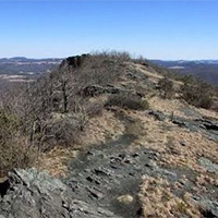
 Read Mountain is a 243-acre park in Roanoke County and one of the county’s largest passive recreation areas.
The park includes a 5-mile trail system with moderate to strenuous levels of difficulty. The main feature of the park is a 2-mile trail to Read Mountain’s summit, known as Buzzards Rock. The view from the top is one of the best in the Roanoke Region.
-
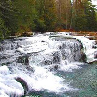
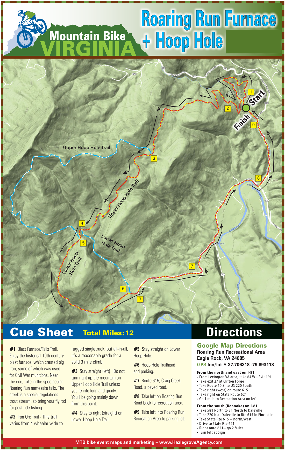
Roaring Run
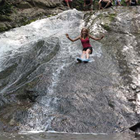 Roaring Run is an excellent hiking trail for the whole family. The easy, well-marked trail begins at a historic iron furnace and winds back and forth along the Roaring Run stream. You will pass rock walls, cascading water, and cross five footbridges before ending at beautiful Roaring Run Falls.
It is also a great trout stream with a natural water slide at lower levels. At higher levels, it becomes a Class V+ creek.
- Easy (out and back hike)
- Approximately halfway to the falls is a natural water slide
- Toilets and picnic area with charcoal grill
-
Rock Castle Gorge
 Rock Castle Gorge is an incredible 11-mile hike just off the Blue Ridge Parkway. There are several variations you can do for shorter mileage but completing the entire loop is worthwhile.
Sheltered within the deep, narrow confines of Rock Castle Gorge is a surprising variety of plant life. There are 200 species of wildflowers, 45 species of trees and 28 species of ferns along the trail. The gorge also has a stunning wildflower display boasting nearly 200 species from April through early May, all within day hiking distance of the Blue Ridge Parkway. The loop encompasses high, open meadows with an impressive panoramic view as well as the narrow confines of the Gorge, making for a strenuous, but rewarding day hike.
-
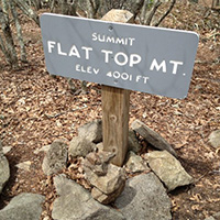
Sharp Top
 The sharp Top hike is a classic 3-mile round trip, out and back hike at the Peaks of Otter.
Sharp Top was long thought to be Virginia’s tallest mountain, when in fact, it is not even the tallest of the Peaks of Otter. Nearby Flat Top rises to 4,001 feet. Mount Rogers near the North Carolina border is Virginia’s tallest mountain at 5,729 feet.
Begin the hike at the Peaks of Otter Visitor Center. Cross the Blue Ridge Parkway staying on the sidewalk for about 200 yards and then turn right across Route 43 heading to the Sharp Top parking area. After crossing Route 43 there is an intersection on the left that leads to the Lake Trail. Stay on the sidewalk and the trailhead is to the left of the Camp Store. The trail is un-blazed but well worn.
For such a short trail to the peak, it will give you quite a workout with multiple series of steps throughout the hike. From the trailhead to the first good overlook is about 1 mile. Continue on the trail for about .3 of a mile and you will reach the Buzzard’s Roost Trail intersection. Bear left and go about 0.2 miles to the top. There is a stone cottage at the peak. The summit offers an impressive 360-degree view of the Peaks of Otter area.
-
Smart View Trail
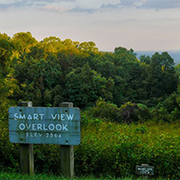 Smart View Recreational Area offers several hiking trails and picnic areas. Located along the Blue Ridge Parkway, Smart View also provides excellent views of the Virginia Piedmont. Three miles of trails meander through moist deciduous woodlands, hardwood forests, and open fields.
This site is a great place to bird during spring migration, but summer also is productive with breeders such as hooded, Kentucky, and black-and-white warblers, Acadian and great-crested flycatchers, blue-gray gnatcatcher, yellow-throated and red-eyed vireos, chipping sparrow, brown thrasher, and scarlet tanager.
-
Smith Mountain Lake Community Park
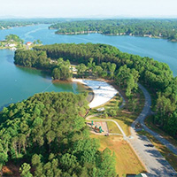 The 37-acre Smith Mountain Lake Community Park opened in June 2007. It is a family-oriented facility providing swimming, fishing, and family recreation.
The park is open year-round and offers a partly-covered handicap accessible fishing pier with seating, picnic shelters with grill, playground area, restrooms, hiking, jogging, and a beach with lifeguards on duty when open.
The park includes 3 miles of pleasant lake and wooded view hiking. Entry and exit points are scattered throughout the park.
-
Stewarts Knob Trail
 Stewarts Knob Trail is an easy half-mile hike located at milepost 110.6 on the Blue Ridge Parkway.
 -
Stiles Falls
 Stiles Falls is a 40-foot waterfall located on Camp Alta Mons property. The trail is closed to the public while summer camp is in session.
The hike is about 3 miles long. From the camp office, walk up the road past the swimming pool, the retreat center, and the pond. Continue along the dirt road until you come to a sign indicating “Falls.” Follow the trail to the falls crossing the creek three times before reaching the falls. The trail is marked with white blazes.
-
Sulphur Springs Ridge & Price Mountain Trail
 This 5-mile loop trail offers you a chance to leave everything behind. Odds of running into another hiker are close to zero. The upper portion of the trail affords views of the surrounding valley and mountains.
Directions
- From I-81, take Exit 150 to Route 220N to Fincastle
- Turn left on Route 606 just before downtown Fincastle
- Continue straight through stop sign
- Follow for ~6.5 miles and you will climb a large mountain
- Park at top on right side
- Trail begins here (not marked)
-
Tinker Cliffs (Andy Layne Trail)
The 6.6-mile out and back hike on the Andy Layne Trail intersects with the Appalachian Trail and ends with incredible views.
From the trailhead, take the yellow-blazed trail for about 3.1 miles to the intersection with the Appalachian Trail. Turn right onto the white-blazed A.T. (southbound) and reach Tinker Cliffs within 0.75 miles. Enjoy the 180 degree view.
From 1,300 feet near the trailhead and creek crossings to just a hair under 3,000 feet at the cliffs. Bluff top views are the most prominent feature, but there are also nice creek drainages, intriguing rock formations, and lovely forests on the way. Even the part of the trail that goes through a cow pasture includes pleasant rushing streams and scenic views up toward surrounding ridges. Some tough, steep stretches as it rises 1,700 feet in elevation.
-
Tinker Ridge/Hay Rock Overlook
 Tinker Ridge Trail crosses Tinker Creek, which is the site depicted in Annie Dillard’s “Pilgrim at Tinker Creek,” then ascends Tinker Ridge at Hay Rock Overloook, providing spectacular views of Carvins Cove and the Roanoke Valley.
The 8-mile round trip hike on the Appalachian Trail is just 15 minutes from Downtown Roanoke and is of moderate difficulty.
-
Tuscarora Trail
 One of the classic trails located inside Douthat State Park. This 10-mile trail is strenuous but rewarding with incredible views and wildlife encounters.
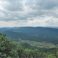
From the Beaver Dam Campground follow the orange blazed Salt Stump Trail up the mountain for 2.43 miles. Take a left onto the white blazed Middle Mountain Trail and follow the top of the ridge for 1.77 miles. Take another left onto the yellow blazed Tuscarora Overlook trail. In about 1 mile you will arrive at a Y intersection. Take a left to the overlook offering sweeping views of the region.
After taking a good break, backtrack to the Y intersection and take a right onto the blue-blazed Blue Suck Falls trail. Follow it down the mountain to the waterfall. Continue to follow the trail along the creek. Make sure to follow the Blue Suck Falls trail all the way down to the Heron Run trail. Take a left onto the Heron Run trail, which takes you on the West side of the lake. You will then traverse the Lakeside Campground and take a left on the main road to reach the Beaver Dam Campground.
-
Virginia Triple Crown Loop
The Triple Crown is a combination of three amazing hiking destinations in Virginia. And they’re all conveniently located right around Roanoke. This overnight backpacking trip begins and ends at the Route 311 Appalachian Trail head. This is a difficult hike totaling about 32 miles.
Click for detailed view.
There are several options for hitting the Triple Crown. There are shuttle systems that will transport you from trailhead to trailhead. You can also take advantage of the Appalachian Trail and hike your way between the trails on the Virginia Triple Crown Loop. The conditions for backpacking are subject to change. Stay updated before your trip and check in with the Roanoke Appalachian Trail Club.
Up for the challenge? We broke it down for you.
McAfee Knob
The most photographed site on the Appalachian Trail includes a nearly 270-degree panorama of Catawba Valley, Tinker Cliffs, and the Roanoke Valley. NOTE: the McAfee Knob trailhead parking lot on Rt. 311 is closed during 2024 while a pedestrian bridge is built across the highway. Learn more and plan accordingly.
- Where: Off Route 311
- Length: 8 mile round trip (out and back hike)
- Difficulty: Moderate (gradual uphill on way up, downhill on return)
- Estimated time: Plan for at least 5 hours
- WARNING: Only park in the trail head parking lot off Rt. 311. DO NOT park on the side of Rt. 311 – you will be towed.
- View Overview Map
- Map and directions
Breakdown: Beginning opposite of the parking lot off Route 311, you join the Appalachian Trail and head north toward the Knob. There’s an informational kiosk about 0.3 miles in. Follow the white blazes (rectangular
paint marks on the trees) to stay on the right path. You’ll cross four wooden walkways and see the Johns Spring shelter. Then you’ll cross five more and pass the Catawba Mountain shelter. Next, cross an old fire road and power line clearing. Walk for another 0.5 mile and turn left on the McAfee Knob spur trail to arrive at the lookout. Come back the way you went up.Insider Tips:
- Parking fills up quickly, and you can’t park on the shoulder of Route 311. Your best bet to guarantee parking is to visit on a weekday or before 8 a.m.
- Another option for larger groups is to stop at the I-81 Exit 140 Park and Ride (click on the green car right by the ‘R’ in Roanoke on the map for directions) and carpool to the trailhead.This hike is lengthy and not to be underestimated, despite being considered the “easier” of the three Triple Crown hikes.
Tinker Cliffs/Andy Layne Trail
 Streams, creek drainages, rock formations, and lush forest offer pleasant views on the hike up, which rises 1,700 feet in elevation. Bluff top views at the peak with a 180-degree panoramic view are spectacular.
- Where: Off Route 779 (Catawba Road)
- Length:7 miles (out and back hike)
- Difficulty: Difficult (lengthy with steep elevation gain)
- Estimated time: 4-5 hours
- Map and directions
Breakdown: You’ll start off of Catawba Road and follow the yellow-blazed Andy Layne Trail. You will cross two fence stiles, then two Catawba Creek bridges. Continue as trail bears left, then right after 100 feet. The hardest part of the hike includes a steep elevation gain with some areas of no switchbacks (zig-zagging). Three miles in, you will join the Appalachian Trail (white blazes). Continue and you will see a view of Broad Run Mountain. Next, you will reach a view of the Catawba Valley. The better view is 200 yards beyond this first view, with McAfee Knob clearly visible. Come back the way you went up.
Insider Tips:
- Stay on the trail – the area around the trail is private and belongs to Roanoke Cement Company.
- The trail gets steep in places, so be prepared.
- Explore the cliffs once you reach the top!
Dragon’s Tooth
 Tuscarora quartzite spires that outcrop on the top of Cove Mountain are the distinguishing feature with the tallest “tooth” projecting about 35 feet above the surrounding “teeth.” The trail ascends the spine of Cove and North Mountain, called “Dragon’s Back” because it is composed of steep rock.
- Where: Off Route 311, past Catawba Grocery
- Length: 5 mile round trip (out and back hike)
- Difficulty: Moderate to difficult (not lengthy, but steady incline that leads to a steep, rugged section)
- Estimated time: Plan for at least 4 hours
- Map and directions
Breakdown: The trail starts with a kiosk at the back of the parking lot. You will follow the blue-blazed trail to the top. Go 0.25 mile and cross two small bridges. You’ll see the intersecting yellow-blazed Boy Scout Connector Trail. Bear right and continue on the blue-blazed trail. Continue for nearly 1.5 miles, crossing the creek several times on a steady incline before reaching the Appalachian Trail intersection. Turn right to go south on the white-blazed Appalachian Trail. There will be 0.7 miles of steep rock steps before bearing left at the intersection to follow the blue-blazed trail to Dragon’s Tooth. Come back the way you went up, or once you reach the Appalachian Trail, go beyond the blue-blazed trail you started on and continue north on the A.T. until you reach the yellow-blazed Boy Scout Connector Trail. You’ll go left on this trail until you reach the blue-blazed Dragon’s Tooth Spur Trail, and go right toward the parking lot. This second route back offers different scenic views.
Insider Tips:
- Take a picture of the map at the kiosk, or bring your own. Despite new signs and a well-marked trail, people can still get lost on the way back down.
- This hike is considered to be harder than McAfee Knob, and the last mile is very rugged, so conserve your energy.
- The parking lot here fills up quickly. The tips for McAfee Knob parking also apply.
Bonus Challenge: Virginia Triple Crown Loop
For added challenge, you can hike all three trails in one continuous backpacking adventure, since they’re all connected by the Appalachian Trail.
Heads Up: That’s 36 miles of hiking in one trip! (This route is not recommended for beginners.)
There are several options for hitting the Triple Crown. There are shuttle systems that will transport you from trailhead to trailhead. You can also take advantage of the Appalachian Trail and hike your way between the trails on the Virginia Triple Crown Loop. The conditions for backpacking are subject to change. Stay updated before your trip and check in with the Roanoke Appalachian Trail Club.
Don’t Forget Supplies
Here’s what we recommend taking for your day hike. (You’ll need more if you’re doing the Triple Crown Loop.)
- Water: Stay hydrated! These hikes are challenging. At least one quart of water per person (2 on a hot day) is strongly recommended. If you’re bringing a four-legged friend, make sure there’s enough water for them as well.
- Snacks/lunch: You’re going to want a bite to eat at some point. Plus, a picnic at the peak of the trail is a great reason to stay longer to soak in the view!
- Camera: Snap a picture from the top so you can always remember the view.
- Supportive shoes: You’ll need sturdy shoes to venture up the mountains – especially the rocks at Dragon’s Tooth.
- Hat/sunglasses/sunscreen: Protect yourself from the sun.
- Rain jacket: In case of pop-up showers.
- Flashlight or head lamp, and warm layers: If the hike takes longer than expected and the sun starts going down, you should be prepared.
Leave No Trace
Stay on the trails and don’t shortcut switchbacks in order to maintain the trails and prevent erosion. Take out anything you bring in. You can also volunteer to join the Roanoke Appalachian Trail Club or their Meetup group to keep the Triple Crown trails beautiful. (Special thanks to the Roanoke Appalachian Trail Club for their insider tips!)
-
Waid Recreation Park
 Waid Recreation Area is a 220-acre facility located near Rocky Mount, along the site of the Old Carolina Wagon Trail. The park is nestled near the Pigg River, which is home of the “Pigg River Ramble.”
More than 400 acres of rolling terrain and creek crossings make this area great for beginners and more experienced hikers and bikers. The location also hosts various special events and athletic leagues.
Amenities include:
- Brand new flow and jump like mountain bike trails
- 7 miles of walking and hiking trails
- Disc golf course
- 2 walking tracks
- Equestrian trails
- Covered picnic shelters, pavilions, and grills
- 2 playgrounds
- Fishing, canoeing, and kayaking
- Soccer, baseball & softball fields


Create Your Own Land Adventure
Get Started Powered by Roanoke Outside
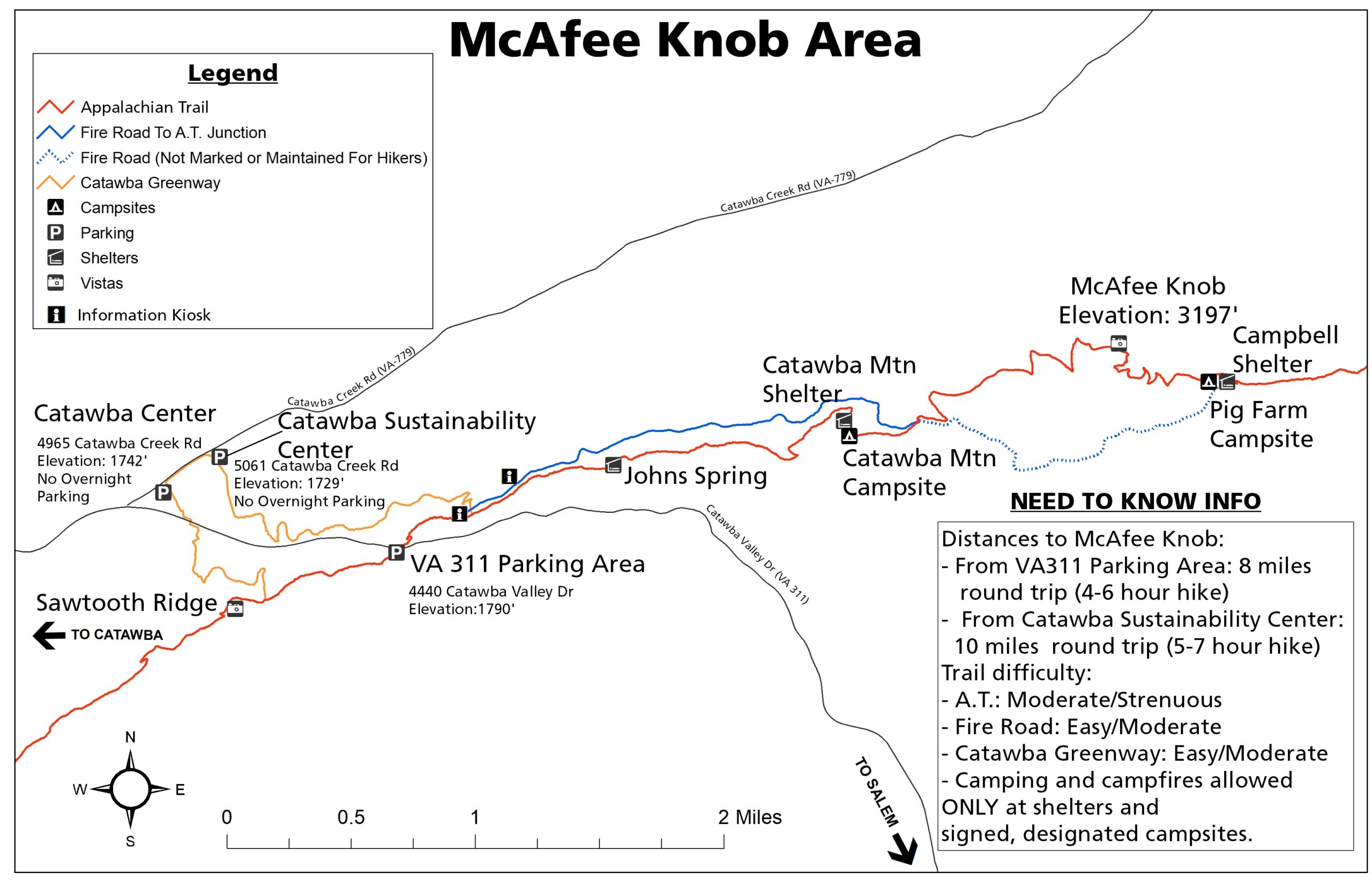