

Craig County Hikes
From an old mine to a raptor observatory, this group of hikes includes a few short options to longer scenic routes.
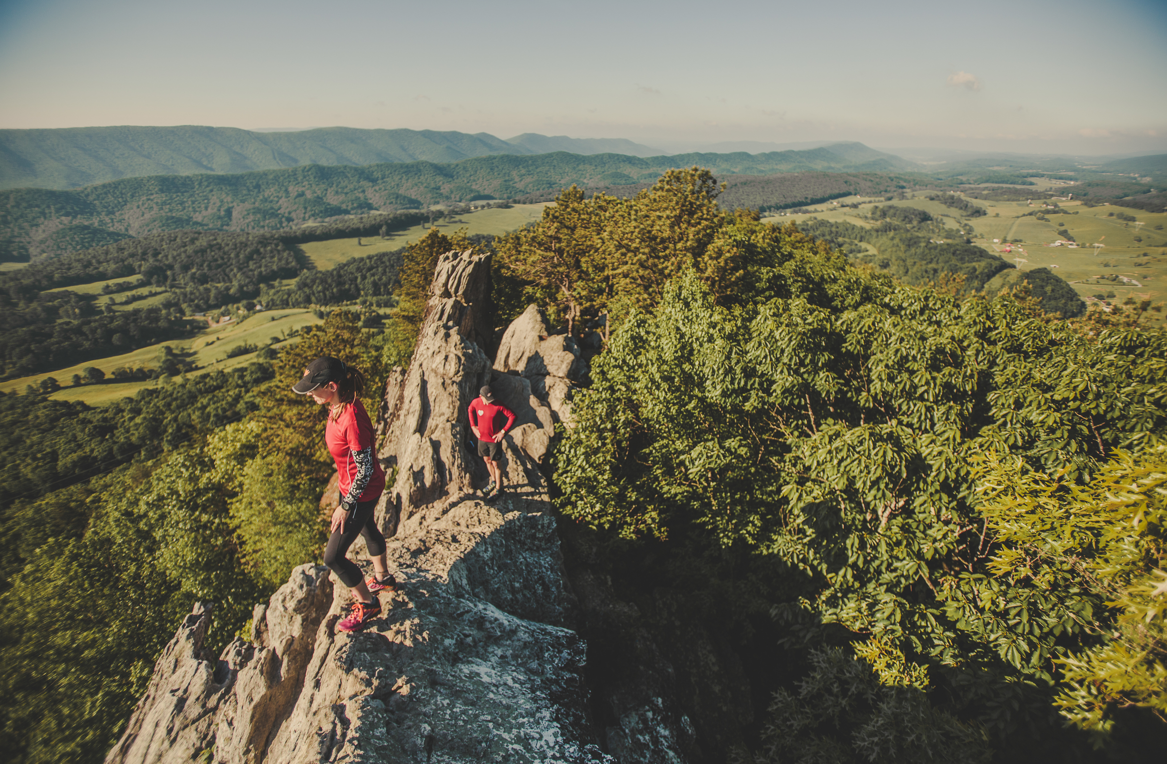
The most-well known hike in Craig County might be Dragon’s Tooth, which includes a unique geologic feature that consists of Tuscarora quartzite spires which outcrop on the top of Cove Mountain. The tallest “tooth” projects roughly 35 feet above the surrounding rock. The trail to Dragon’s Tooth ascends steep, rugged outcrops of quartzite which form the spine of Cove Mountain and North Mountain.
The other can’t-miss hike includes the half-hour jaunt up to Hanging Rock Observatory. Since 1952, Hanging Rock has been a monitoring point for hawk, eagle, falcon, and osprey migration along the birds’ eastern route (August through November).
Find Your Trail
Craig County Hikes
-
Dragon’s Tooth


Dragon’s Tooth is a unique geologic feature that consists of
 Tuscarora quartzite spires which outcrop on the top of Cove Mountain. The tallest “tooth” projects roughly 35 feet above the surrounding rock. The trail to Dragon’s Tooth ascends steep, rugged outcrops of quartzite which form the spine of Cove Mountain and North Mountain. The spine is known as Dragon’s Back.
Note: The Dragon’s Tooth hike is one of the most popular hikes along the entire Appalachian Trail and sees a tremendous amount of hiker traffic. The trailhead parking lot (Rt. 311) has limited space; DO NOT PARK on Rt. 311 – YOU WILL BE TOWED. It is ideal to hike this on a weekday as weekends are very crowded. Vehicles not parked in the parking lot are subject to tow. Please read specific rules and regulations at the bottom of this description.
Hike Description
- ~ 4.5 mile round trip, out and back hike.
- Moderate to difficult.
- 20 minutes from downtown Roanoke.
- Map kiosk at trailhead (very straight forward hike). Take a picture of the map so you have it on your phone.
- The trail starts with a kiosk at the back of the parking lot. You will follow the blue-blazed trail to the very top.
- Go 0.25 mile and cross two small bridges.
- You’ll see the intersecting yellow-blazed Boy Scout Connector Trail. Bear right and continue on the blue-blazed trail.

- Continue for nearly 1.5 miles, crossing the creek several times on a steady incline before reaching the Appalachian Trail intersection.
- Turn right to go south on the white-blazed Appalachian Trail. There will be 0.7 miles of steep rock steps before bearing left at the intersection to follow the blue-blazed trail to Dragon’s Tooth.
- Come back the way you went up, or once you reach the Appalachian Trail, go beyond the blue-blazed trail you started on and continue north on the A.T. until you reach the yellow-blazed Boy Scout Connector Trail. You’ll go left on this trail until you reach the blue-blazed Dragon’s Tooth Spur Trail, and go right toward the parking lot. This second route back offers different scenic views.
Directions to Trail Head
- From Roanoke – take I-81 south to Exit 141. Turn left at the traffic light onto Rt. 419 (Electric Rd.) and follow 0.4 miles to next traffic light (Rt. 311). Turn right onto Rt. 311N and follow for 10 miles. Dragon’s Tooth parking lot is on left just past Catawba Grocery.
Rules & Regulations
- Max. group size for day hikes is 25 people.
- Max. group size for backpacking/camping is 10 people.
- No alcohol
- Bring lots of drinking water
- Bring a flashlight as groups often lose track of time and are hiking back in the dark
- Dogs must be on leash at all times (be aware there is a section where you will have to lift your dog up a 6′ wall)
- No camping or campfires on Dragon’s Tooth, McAfee Knob or Tinker Cliffs
- Practice Leave No Trace
- Pack out all trash
- No camping or campfires outside of the 7 designated shelters/camping areas.
- Visit local A.T. C. Club for more details.
Add On
- Finish your day with a great meal at the Home Place – a restaurant famous among thru hikers. To reach the Home Place, continue north on Rt. 311 for ~1 mile to a large white farmhouse on left.
- Grab a beer at Parkway Brewing Co.
- Go see a baseball game! Click here for Salem Red Sox schedule
-
Fenwick Mines
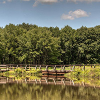 Fenwick Mines was once an old mining area and is now home to trails and a recreation park. The trail takes you by open pit mines and foundations of old mining structures.
The Fenwick Forest Walk is a 1-mile nature trail. The wetland trail allows you to observe wetlands created by beavers; follow the trail through wetlands and open forests to see a variety of wildlife and vegetation that live in this environment.
The trails are wheelchair accessible. The site has a large picnic shelter, grills, toilets, and a fishing pond.
-
Ferrier Trail & Lick Branch Loop
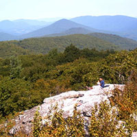
A 7-mile loop trail that provides good views of Craig Creek Valley and Potts Mountain. Lick Branch offers a cool refreshing walk, except during dry periods. A sign marks intersection of the Lick Branch and Ferrier trails.
-
Hanging Rock Raptor Observatory
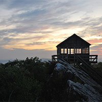 Hanging Rock Raptor Observatory is a half-hour hike with great views (and birdwatching) located in Monroe County, West Virginia. The hike takes you to the observatory. Since 1952, Hanging Rock has been a monitoring point for hawk, eagle, falcon, and osprey migration along the birds’ eastern route.
Hanging Rock Tower is a simple forest service fire tower on top of a mountain. There is no electricity, running water, or bathroom facilities other than an outdoor toilet. You need to take drinking water. Other items you may want to consider are binoculars, food, sunglasses, an extra layer of clothing, sunscreen, hat, bird books, and comfortable hiking shoes.
The hike up the mountain takes 20 to 40 minutes.
-
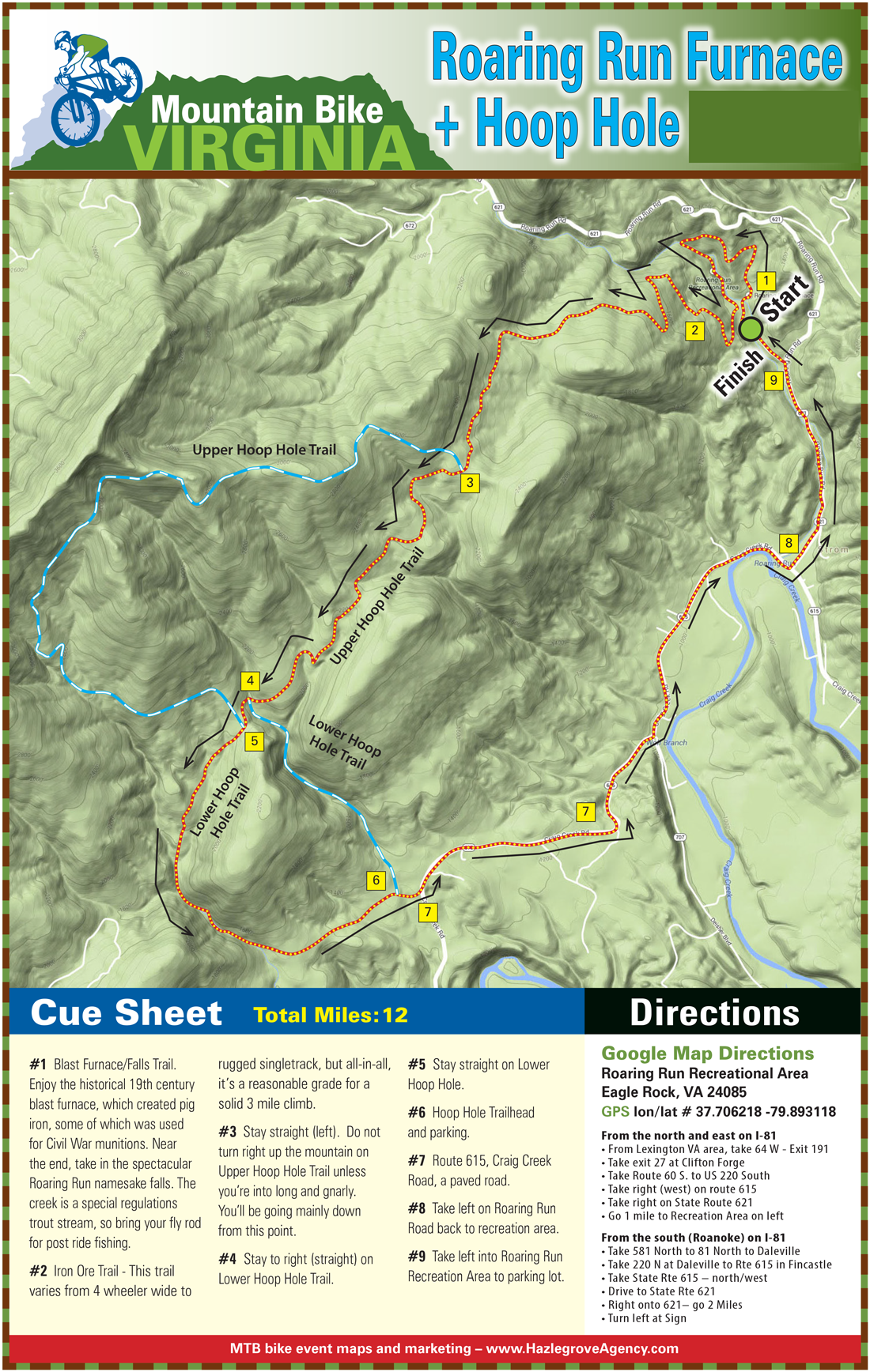
Hoop Hole
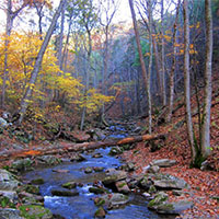 Hoop Hole Loop has two loops. The lower loop is 4 miles and skips the views from the ridge top and the extended loop is 9 miles. Both loops offer beautiful views of the streams cascading over rocks and swimming holes.
The longer loop climbs to the top of the ridge for scenic views of the surrounding mountains. One could try to reach certain cliffs from the ridgetop for more expanded views. The trail is very rugged and good footwear is necessary. Also, the trail makers are sometimes difficult to see with yellow blazes.
-
Lipes Branch Trail
 A 2.3-mile (round trip) hike up Potts Mountain. The trail passes through the Barbours Creek Wilderness Area and is located near Pines Campground.
- Recommended for more experienced hikers; the first half of the hike is all uphill.
- There are yellow blazes to follow, but they are old and faded and hard to see.
- Allowing four hours for the hike is recommended.
Elevation on top of Potts Mountain is over 3,600 feet, affording great views in all directions. There are no facilities on the trail, but connector (white-blazed) trailheads to Pines Campground have hand pumps for water and vault toilets.
-
Patterson Creek Trail System
 Located on the border of Craig and Botetourt counties is the Patterson Creek Trail System. This forgotten hiking trail system that is being revived by the Roanoke IMBA chapter and includes multiple loop options and fairly difficult terrain.
 -
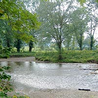
Roaring Run
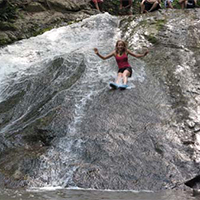 Roaring Run is an excellent hiking trail for the whole family. The easy, well-marked trail begins at a historic iron furnace and winds back and forth along the Roaring Run stream. You will pass rock walls, cascading water, and cross five footbridges before ending at beautiful Roaring Run Falls.
It is also a great trout stream with a natural water slide at lower levels. At higher levels, it becomes a Class V+ creek.
- Easy (out and back hike)
- Approximately halfway to the falls is a natural water slide
- Toilets and picnic area with charcoal grill
-
Wilderness Adventure at Eagle Landing
Located 40 minutes from downtown Roanoke in scenic Craig County, Wilderness Adventure at Eagle Landing is a full-service outdoor adventure center, campground, cabin rentals, summer adventure camp, and retreat center. Wilderness Adventure at Eagle Landing specializes in creating custom adventure programs for groups ranging from two to 100 people.


Create Your Own Land Adventure
Get Started Powered by Roanoke Outside