
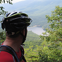
Alleghany Highlands Hikes
The Alleghany Highlands is an outdoor recreation, and hiking, mecca with plenty of trails to explore.
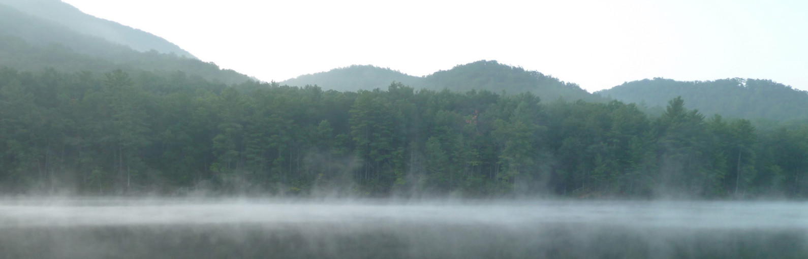
Douthat State Park was named one of the nation’s 10 best state parks by the Outside Family Vacation Guide. The park is on the National Register of Historic Places and is one of the original six Virginia State Parks that opened in 1936. It’s nestled in the Allegheny Mountains and features some of Virginia’s most outstanding scenery. There are over 43 miles of varied difficulty trails created originally by the Civilian Conservation Corps.
Another highlight of the Alleghany Highlands is the Jackson River Scenic Trail, which includes 17 miles developed along an old railroad bed along the Jackson River. The trail runs from Covington to Coles Point Recreation Area at Lake Moomaw.
Find Your Trail
Douthat State Park & Alleghany Highlands Hikes
-
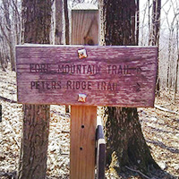
Beards Mountain Trail


 Beards Gap Trail starts up right side from the Douthat State Park visitor center, and initially passes over a wooden footpath. Follow the blue-blazed trail as it heads up the gap. The trail will make several switchbacks before arriving at the ridge, and intersection of the Bushy Hollow and Mountain Top trails in 1.1 miles.
Follow several other trails for a 5+ mile loop hike.
-
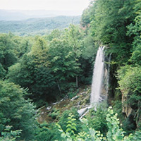
Blue Suck Falls
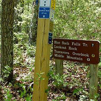
 The Blue Suck Falls Trail is an 8-mile moderate to difficult multi-use trail that connects several of the trails in the northwest region of the park to the trail head near the visitor center at Douthat State Park.
The falls and trail get their unusual name from the Appalachian term for a whirlpool or a “suck,” which may be found at the base of the falls. At higher elevations, the trail traverses the ridge top, often along a narrow path, and connects to the George Washington National Forest trail network. The trail features several east facing overlooks of the Alleghenies such as Lookout Rock. A highlight of the trail are the views of Blue Suck Falls. This rocky trail is actually steeper and more difficult at lower elevations.
-
Buck Run & Locust Spring Run Trails
 Buck Run and Locust Spring Run Trails are located on the turn-of-the-century railroad tram grades used by the previous landowner to log virgin timber.
- The 2.9-mile Buck Run trail provides a spectacular view of beaver ponds, open glades, and bogs.
- The 3.1-mile Locust Spring Run trail provides views of northern hardwoods and is ideal for viewing whitetail deer and wild turkey.
-
Cobbler Mountain Trail
 This trail offers 2.67 miles of excellent hiking in the Hidden Valley Recreation Area.
This trail meanders through a variety of habitats and offers many opportunities to view wildlife. Begin at the shale pit and take the short climb to the ridge top before ascending to the Chimney Run crossing. Enjoy rock formations and the cool stream environment while you cross over a wooden bridge. Hike through a small field with views of the Warwick Mansion and the Hidden Valley fields. Enter the woods in a serene valley located next to a wildlife pond, where it is common to observe waterfowl. Continue on an old road bed that leads to Muddy Run and the Jackson River. The trail ends on the Muddy Run Trail, approximately 1.5 miles northeast of the parking lot by Warwick Mansion.
-
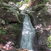
Falling Spring
 Falling Spring Falls is a breathtaking 80-foot waterfall that is one of the most visited and photographed spots in the Alleghany Highlands. The waterfall is on Route 220, just 5 miles north of Covington. This is one of the largest waterfalls in Virginia and cascades from an overhanging ledge that is visible from the roadway.
Thomas Jefferson described Falling Spring as a “remarkable cascade … falling over a rock about 200 feet to the valley below.”
-
Fore Mountain Trail
 A remote 14-mile trail that passes near the highest point in the Allegheny Mountains. It passes through upland hardwoods and pines that are typical of high elevation forests. It is part of a trail system around Douthat State Park.
 -
Jackson River Scenic Trail
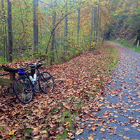 A 17-mile trail in Alleghany County, Virginia, which runs from Covington to the Coles Point Recreation Area at Lake Moomaw. The trail, which was developed from an old railroad bed, provides access to many natural, historic and scenic resources.
The Jackson River, running adjacent to the trail, contributes a distinct and scenic landscape feature while providing a natural habitat for reproducing wild trout. There are 14 miles open to the public for those who enjoy hiking, biking, and nature walks.
-
McDowell Battlefield Trail
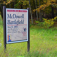 The McDowell Battlefield Trail leads to the top of Sittlington Hill and the core of the McDowell Battlefield. A marker will direct you either east returning to the parking area or west to continue to the western end of the trail.
The eastern end of the trail starts on the south side of Route 250 at the battlefield parking area, approximately 1 mile from the top of Bullpasture Mountain. The western end of the trail starts on the south side on Route 250, directly across from the old mill on the Bullpasture River.
-
Tuscarora Trail
 One of the classic trails located inside Douthat State Park. This 10-mile trail is strenuous but rewarding with incredible views and wildlife encounters.
From the Beaver Dam Campground follow the orange blazed Salt Stump Trail up the mountain for 2.43 miles. Take a left onto the white blazed Middle Mountain Trail and follow the top of the ridge for 1.77 miles. Take another left onto the yellow blazed Tuscarora Overlook trail. In about 1 mile you will arrive at a Y intersection. Take a left to the overlook offering sweeping views of the region.
After taking a good break, backtrack to the Y intersection and take a right onto the blue-blazed Blue Suck Falls trail. Follow it down the mountain to the waterfall. Continue to follow the trail along the creek. Make sure to follow the Blue Suck Falls trail all the way down to the Heron Run trail. Take a left onto the Heron Run trail, which takes you on the West side of the lake. You will then traverse the Lakeside Campground and take a left on the main road to reach the Beaver Dam Campground.

Create Your Own Land Adventure
Get Started Powered by Roanoke Outside